Maps

Historical maps of the British Empire at key points in its expansion and contraction. Annotated with context.

British Empire at its greatest extent (1922)

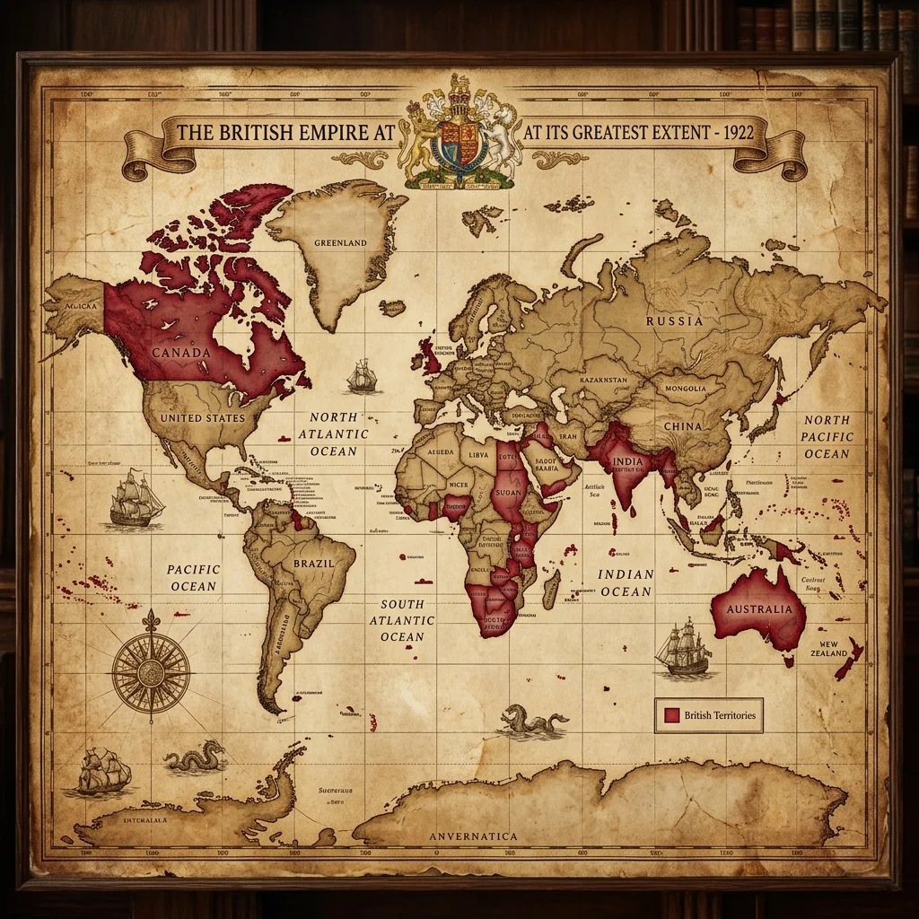
Empire at its Greatest Extent (1922)

Following the Treaty of Versailles and the acquisition of League of Nations mandates from the defeated Ottoman and German empires, British imperial sovereignty reached its territorial peak, covering roughly a quarter of the world's land area and population.

Imperial Trade Routes and Naval Coaling Stations

Trade Routes and Naval Bases

A map of the global maritime telegraph cables, coaling stations (such as Gibraltar, Aden, Singapore, and Hong Kong), and shipping lines that protected the Pax Britannica and facilitated global commerce throughout the nineteenth century.

Partition of India (1947)

Partition of India (1947)

The border divisions demarcated by the Radcliffe Boundary Commission, partitioning British India into the independent dominions of India and Pakistan (comprising West and East Pakistan), altering the geopolitical structure of South Asia.

Decolonisation Timeline Map

Decolonisation Timeline

Chronological map tracking the progression of self-determination, starting from the independence of India (1947), moving through the Wind of Change in Africa (1950s-1960s), and culminating in the transfer of Hong Kong (1997).